
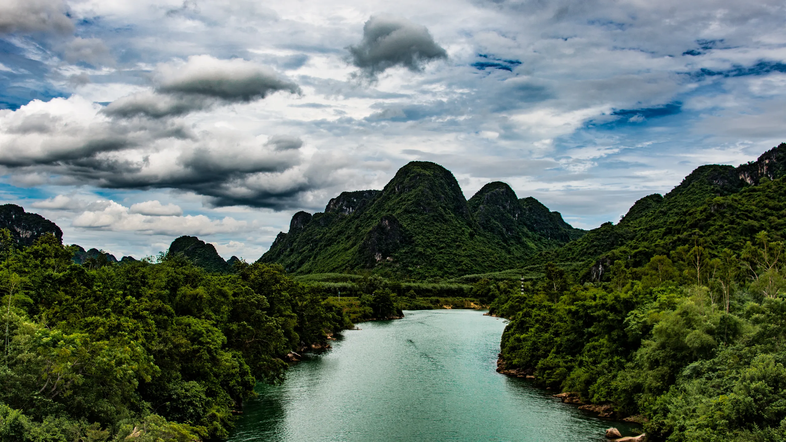
In the 1991-2020 normal for Ha Tinh, the nearest complete weather station to Phong Nha, October brings 742 mm of rain. At Waitomo the wettest month, July, brings 129 mm (an older 1981-2010 normal, from Hamilton). Anyone searching for "caves rainy season" meets both places under the same two words, and the words mean very different things.
This page puts four regions on one chart, says where each number comes from, and explains why the water that closes a cave often arrives from somewhere else. It also says what a rainfall table cannot do. It cannot tell you about Tuesday.
How rain gets into a cave, and why the sky above it proves little
The US National Park Service defines karst as a landscape where dissolving rock has created sinkholes, sinking streams, caves and springs (NPS). In that kind of landscape a stream can vanish into the ground in one place and surface somewhere else, and a cave is often the plumbing in between.
The Kentucky Geological Survey, writing about sinkhole flooding in the United States, gives the plainest account of what happens next. Most flooding occurs when the rate of inflow from rain or snowmelt exceeds the rate of water flow that the conduits and cave passages can transmit. A karst conduit has fixed dimensions, unlike an open stream channel, so large increases in pressure are needed for comparatively small increases in flow. The same page notes that this flooding usually happens during the storms that flood rivers (KGS).
That is a Kentucky text about houses in sinkhole valleys, not about a tour. The principle is general to karst. We found no equivalent official page for any of the four places below, and we say so where it matters.
Four places, four different rains
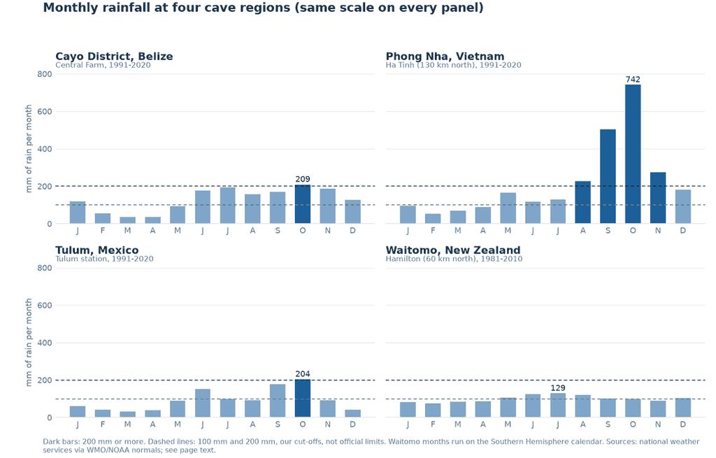
The chart uses one scale for all four panels, on purpose. Put Phong Nha next to Waitomo and the word "wet" stops meaning the same thing.
| Region | Driest month | Wettest month | Months at 200 mm or more | Station |
|---|---|---|---|---|
| Cayo District, Belize | April, 35 mm | October, 209 mm | 1 | Central Farm, a few km from San Ignacio |
| Phong Nha, Vietnam | February, 54 mm | October, 742 mm | 4 (August to November) | Ha Tinh, 130 km north |
| Tulum, Mexico | March, 33 mm | October, 204 mm | 1 | Tulum, 2 km from town |
| Waitomo, New Zealand | February, 74 mm | July, 129 mm | 0 | Hamilton, 60 km north, 1981-2010 |
| Ninh Binh, Vietnam | February, 19 mm | August, 335 mm | 3 (June to August) | Hanoi, about 90 km north |
| Cu Chi, Vietnam | February, 8 mm | September, 273 mm | 6 (May to October) | Ho Chi Minh City, about 30 km |
Four of the six stations are tens of kilometres from the caves. We say how far each one is, because a normal read 130 kilometres away gives the shape of the year, not a reading at the entrance. The files come from national weather services through the WMO and NOAA: Belize, Vietnam, Mexico and New Zealand.
Cayo District, Belize
Six months, June to November, each bring between 157 and 209 mm. The Belize weather service says most of the year's rain falls from June to November, that the season reaches Cayo in late May, and that it has a pause in August known as the "Mauga" (National Meteorological Service of Belize). The normal shows it: 157 mm in August against 194 in July. The short months are the dry ones, February to April, at 56, 37 and 35 mm.
The dry months are not a guarantee, and a Belizean broadcaster has the evidence. On Christmas Eve 2022 flash floods spread across Cayo, and its news site's headline list for that day reads "Christmas Eve Flash Floods Claim Tour Guide's Life at Caves Branch". Dozens of tourists on ATM Cave tours were stranded upriver. One guide told the reporter that the water level was "low, nice and clear" when the group went in, and that there were flash floods when they came out. Asked whether that was normal for the time of year, he said: "I wouldn't say normal but this time of the year we usually don't get it but it can happen. It has happened before." The broadcaster reported rapidly rising rivers with no rain in the immediate area in the preceding days, because rain over the hills had emptied into the creeks (Channel 5 Belize, 27 December 2022).
December averages 126 mm at Central Farm, which our table marks as workable. Workable is not the same as safe, and the same guide made a point worth repeating: some visitors decline life vests because they think they are strong swimmers, and the rule is to wear them. The Cayo District page covers the caves, ATM Cave and cave tubing have their own.
Phong Nha, Vietnam
August is 228 mm, September 504, October 742 and November 274 at Ha Tinh. Vietnam's tourism authority says dry weather is best for caving, calls September to December flood-prone months best avoided, and names February to August as the best time (vietnam.travel).
We differ from the authority on one month. December averages 181 mm at Ha Tinh, under our 200 mm line, so our table calls it workable where the authority says avoid. The difference is small, and you should follow the authority.
The awkward part sits on the other side of the year. The months the authority recommends, May to August, are the hot ones: average highs at Ha Tinh run from 33 to 35 °C. The months that win on rain alone, January to April, are also cooler, with highs between 21 and 29 °C. So the choice is partly a choice between wet and hot, and the weather table does not make it for you. The Phong Nha tours page has the caves.

Tulum, Mexico
October is the wettest month at the Tulum station, with 204 mm, followed by September at 177 and June at 151. March is the driest at 33. The US National Hurricane Center says the Atlantic hurricane season runs from 1 June to 30 November, and that in its 1991-2020 climatology the first hurricane tends to form in early to mid-August and the first major hurricane in late August or early September (NHC). So Tulum's two wettest months fall in the stretch of the season when storms are most likely, while June and July are rainy but earlier.
What the rain does inside a cenote is a different question. A cenote is a flooded sinkhole formed by the collapse of limestone bedrock (Microbial Ecology, 2024), and our cenotes explained page covers the types. We found no official source on how a wet month changes water clarity or access at the cenotes around Tulum. The weather services give rain and storm dates, nothing more. A claim that cenotes are clearest in the wet season, or in the dry one, is not backed by a measurement we could open, so we do not make it. The Tulum tours and the water caves guide cover the visits.
Waitomo, New Zealand
The year is flat. No month reaches 130 mm, and the driest, February, still collects 74. The only normal we could open is Hamilton's for 1981-2010, 60 kilometres north, so it is older than the others and the distance is real. The wettest months are the winter ones, June to August, when average highs are about 14 to 15 °C. The rainy season at Waitomo is the cold season.
The company that runs the Ruakuri Cave tours says on its safety page that heavy rain can raise water levels and make roads or walkways slippery or impassable, that weather and water levels are monitored, and that tours may be rescheduled or canceled (Discover Waitomo). It is an operator's page, not a regulator's, and it gives no threshold. The Waitomo tours page has the caves.
Ninh Binh and Cu Chi
Around Ninh Binh, where the Trang An and Tam Coc boats run, Hanoi's normal puts June, July and August at 231, 300 and 335 mm. The tourism authority names April to June as the best time for the scenery, because the rice fields around Tam Coc turn golden in late May, and calls autumn cool and clear (vietnam.travel). It is judging the landscape, we are counting rain, and the two disagree about June. Cu Chi has six months at 200 mm or more, May to October, though the authority describes the wet months as short afternoon showers (vietnam.travel), which is not a contradiction: short showers add up. See Trang An and Tam Coc and Cu Chi.
How we turned rainfall into a table
The table below gives each month one of three labels from two numbers: monthly rain and, for heat, the average daily high. A month is wet at 200 mm or more, roughly 6.5 mm a day. It is drier under 100 mm, roughly 3.3 mm a day, and under 34 °C. At Tulum and Cayo, months inside the hurricane season are never marked drier. Everything else is wetter but workable.
Both lines are ours. An official body does not publish them. We tested how much they matter: move the 200 mm line to 160 and 9 of the 72 monthly cells in this table change label, move it to 240 and 8 do. Cayo in January, at 119 mm, sits just above the 100 mm line. Treat a label as a nudge toward checking the place, not a verdict.
Which months are drier at six river, jungle and cenote caves
| Month | 1 | 2 | 3 | 4 | 5 | 6 | 7 | 8 | 9 | 10 | 11 | 12 |
|---|---|---|---|---|---|---|---|---|---|---|---|---|
| Ninh Binh (Trang An & Tam Coc) Water peaks Jun-Aug; the tourist board prefers Apr-Jun for the scenery, so the two views differ. Data from Hanoi, about 90 km north. | 1 | 2 | 3 | 4 | 5 | 6 | 7 | 8 | 9 | 10 | 11 | 12 |
| Cu Chi Tunnels A wet-season pattern: showers from May, driest Dec-Mar. Data from Ho Chi Minh City, about 30 km away. | 1 | 2 | 3 | 4 | 5 | 6 | 7 | 8 | 9 | 10 | 11 | 12 |
| Phong Nha The tourist board advises avoiding the flood-prone Sep-Dec, which this table also reads as wet. Data from Ha Tinh, 130 km north. | 1 | 2 | 3 | 4 | 5 | 6 | 7 | 8 | 9 | 10 | 11 | 12 |
| Tulum (cenotes) Hurricane season (1 Jun-30 Nov, NOAA) matters more than rainfall here. Data from an official station 2 km from town. | 1 | 2 | 3 | 4 | 5 | 6 | 7 | 8 | 9 | 10 | 11 | 12 |
| Cayo District (ATM Cave, cave tubing) Rainy season Jun-Nov, with a short dip in August (Belize met service). Data from Central Farm, a few km from San Ignacio. | 1 | 2 | 3 | 4 | 5 | 6 | 7 | 8 | 9 | 10 | 11 | 12 |
| Waitomo Glowworm Caves No month reaches the wet line, so rainfall alone does not mark a season here. Data from Hamilton, 60 km north, older normal. | 1 | 2 | 3 | 4 | 5 | 6 | 7 | 8 | 9 | 10 | 11 | 12 |
1991-2020 normals; Waitomo 1981-2010. Drier: under 100 mm and under 34 C. Wet: 200 mm or more. Both lines are ours, not an official limit.
What a rainfall table cannot tell you
It cannot tell you about a given day. The Christmas Eve flood happened in a month the table calls workable, with no rain nearby, because the water came down from the hills.
It cannot tell you how far the station is from the water that matters. Ha Tinh is 130 kilometres from Phong Nha. Rain falling on the wrong side of a mountain range changes nothing at a river you are standing in, and the reverse is true too.
And it cannot tell you what a seller will do. Read what each tour does when the water is high before you pay, and ask the questions on our canceled-tour page. Our safety guide covers what to wear in the water, and the when-to-go page puts every destination on one matrix.
A rainfall table tells you which months raise the odds of high water. It cannot tell you about one day: in December 2022 the river rose with no rain nearby.
If you book through the links on this site, we earn a commission from the booking platform at no extra cost to you. It does not change the rainfall.
Questions about caves and rain
Is the rainy season a bad time to visit caves?
It depends on the cave and on what you call rainy. October at Phong Nha brings 742 mm and the wettest month at Waitomo 129, so the phrase covers very different things. Check the month for the place, then ask the seller what the tour does when water is high.
Which month is driest at each place?
From the official normals above: April at Cayo (35 mm), February at Phong Nha (54 mm), March at Tulum (33 mm) and February at Waitomo (74 mm, the older normal). The driest month is not always the best one: at Phong Nha the hottest months follow it.
Can a cave flood when it has not rained where I am?
Yes. In December 2022 flash floods in Cayo District came with no rain nearby, because rain on the hills reached the creeks and rivers, according to the Channel 5 Belize report. The Kentucky Geological Survey describes the general mechanism: runoff exceeding what the conduits can carry.
Are cenotes better in the rainy season?
We could not find a measurement either way, so we do not say. The weather services give rain and hurricane dates for Tulum, and nothing about water clarity. The cenotes explained page covers what a cenote is.
Does the hurricane season mean caves are closed?
Not in anything we read. The National Hurricane Center gives the season dates, 1 June to 30 November, and the typical start of hurricane formation in August. Whether a given cave closes for a storm is the operator's call, so ask.
Data verified on . National weather-service normals (1991-2020; Waitomo 1981-2010), NHC, KGS, NMS Belize, vietnam.travel and Channel 5 Belize, read 19 October 2026.
Cave tours in Cayo District, Belize
The ATM Cave and cave tubing tours from San Ignacio.
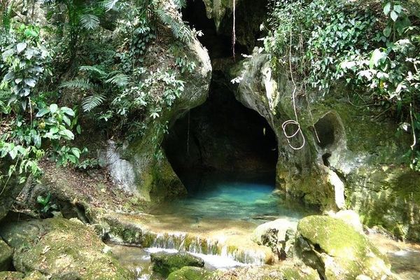
ATM Cave Day Trip From Cayo Welcome Center With Sit-Down Lunch
A 7:00am start at the Cayo Welcome Center, a sit-down lunch, towels and park fees included, and up to 30 travelers per booking on this ATM Cave day trip.
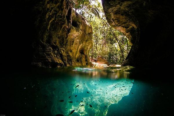
ATM Cave Expedition From San Pedro With Belize City Meeting Points
Travelers from San Pedro and Caye Caulker reach Belize City on their own and meet a licensed guide for an eleven-hour ATM Cave expedition with entrance fee.
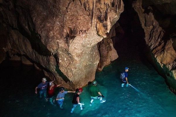
ATM Cave Exploration on Foot From Placencia With Private Transport
A ten-hour, on-foot exploration of Actun Tunichil Muknal from Placencia with private transport, lunch, bottled water and cave gear covered in the price.
Ratings collected by Viator and Tripadvisor
Choose your month, then your tour
Cayo District has the most rain-sensitive caves in this guide. Read each tour's terms for high water before you book.